

İçindekiler
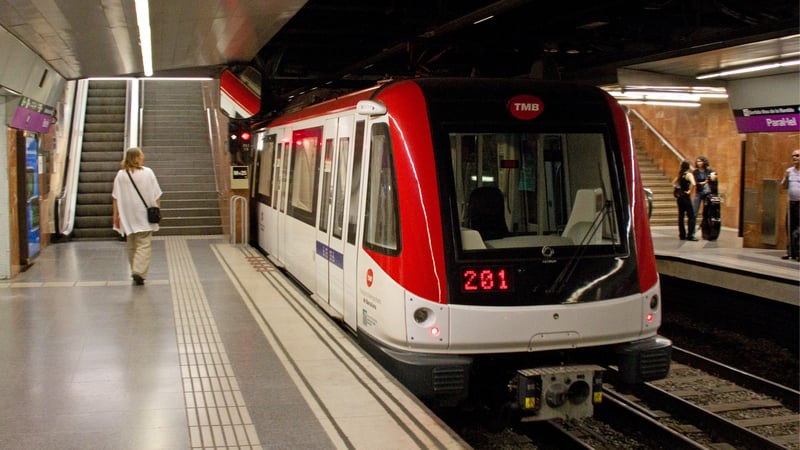
The foundations of Barcelona’s metro were laid in the 1920s, with the first line opened in 1924 between Plaza Catalunya and Lesseps forming the basis of today’s L3 line. The metro line, which was only a few kilometers long at the time, showed great development over the years. During the Spanish Civil War, metro stations were used as shelters, and the expansion of the metro network stopped during this period. However, after the 1950s, with the growth of the city, the metro network began to expand rapidly. In this article, I will try to convey all the details of the metro system and line information.
Barcelona Metro Lines
In Barcelona’s metro system, each line has its own unique color, and these colors make transportation quite easy in the city. Directional signs, wall markers, and maps in metro stations are in complete harmony with this color system. The color coding provides great convenience especially for tourists.
Even if you don’t know Spanish or Catalan, you can easily reach where you want to go by following the colors. For example, if you want to go to Sagrada Familia, you just need to follow the purple L2 line or the blue L5 line.
Colors become even more important at transfer stations. At these points where different lines intersect, each line guides passengers while maintaining its own color. For example, at the metro station in Plaza Catalunya, you can easily understand the intersection of red (L1), green (L3), and purple (L2) lines by following the colors.
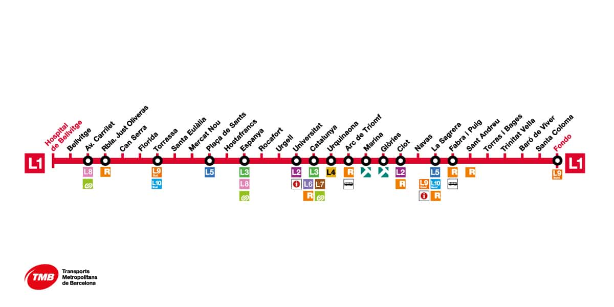
L1 (Red Line)
The red line, which runs from Hospital de Bellvitge to Fondo, is one of the busiest lines in the city. It provides an important connection between tourist areas and business centres, stopping at important stops such as Catalunya Square and Glòries.
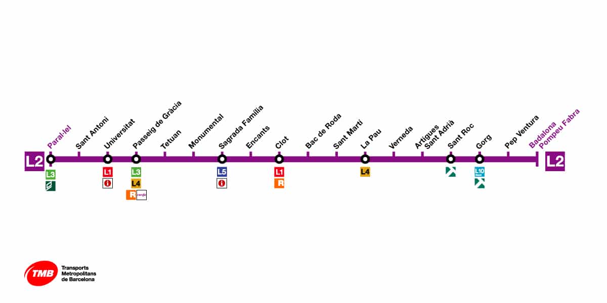
L2 (Purple Line)
The purple line, which runs from Parallel to Badalona Pompeu Fabra, runs parallel to the coastline. Providing access to important tourist spots such as Sagrada Familia, this line operates on the east-west axis of the city.
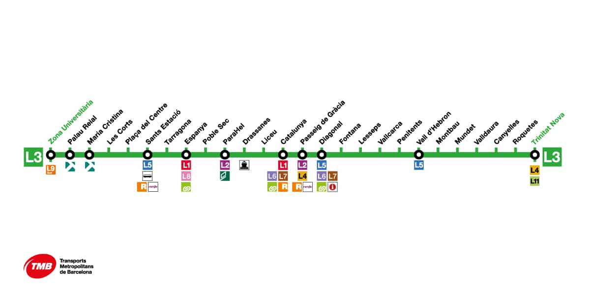
L3 (Green Line)
The Green Line, which runs from Zona Universitària to Trinitat Nova, is the oldest metro line in Barcelona. It runs through the historic centre of the city and provides easy access to tourist attractions such as Las Ramblas and Park Güell.
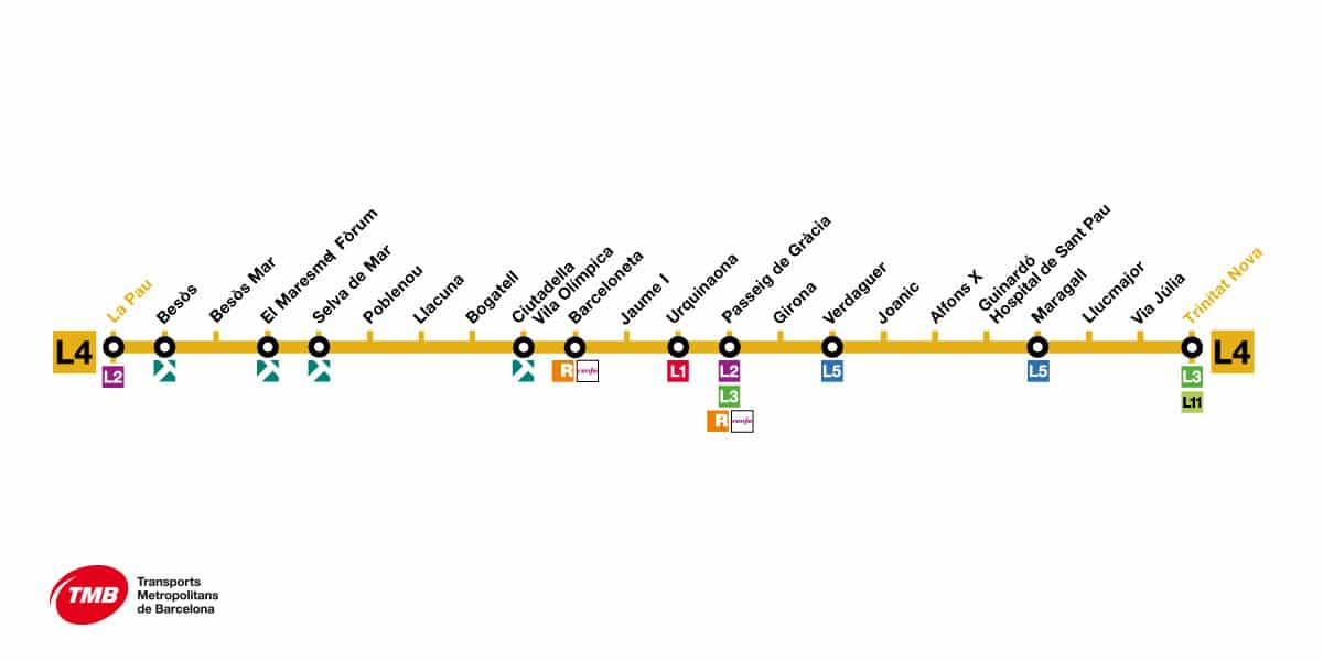
L4 (Yellow Line)
The yellow line, which runs from La Pau to Trinitat Nova, connects the coastal area with the northern part of the city and is a preferred route especially for reaching the beaches.
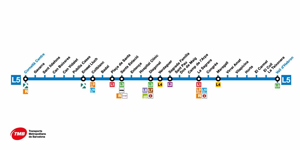
L5 (Blue Line)
The blue line, running from Cornellà Centre to Vall d’Hebron, connects the western and northern regions of the city, playing an important role in providing access to healthcare centers and university campuses.
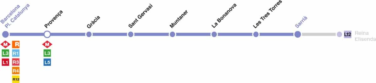
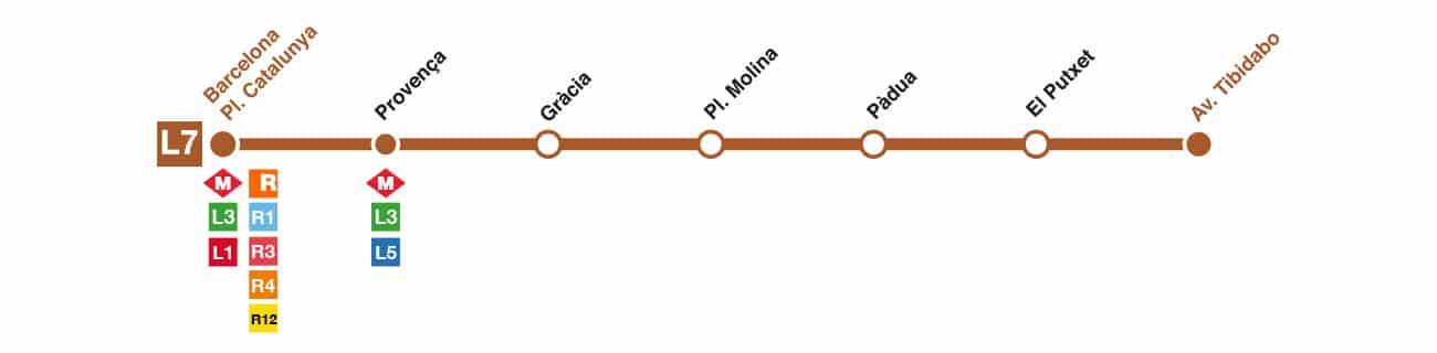
L6 and L7 (Reina Elisenda and Avinguda Tibidabo Lines)
The L6 Reina Elisenda line and the L7 Avinguda Tibidabo line serve mostly residential areas in the higher parts of the city and operate integrated with other lines.
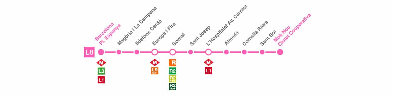
L8 (Molí Nou Line)
Serving the suburban areas of Barcelona, this line provides a connection to the city center and is used heavily, especially during commuting hours.
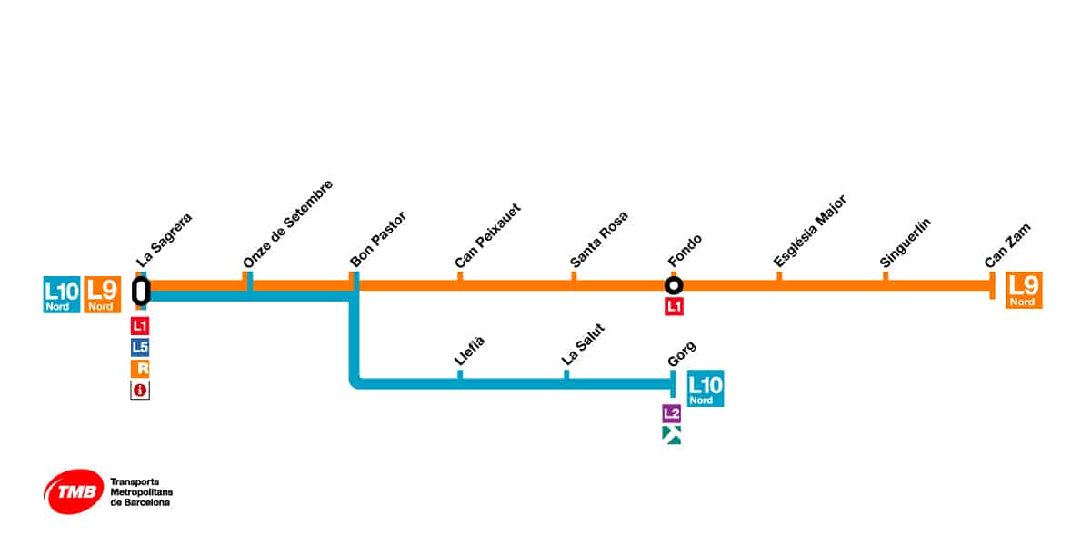
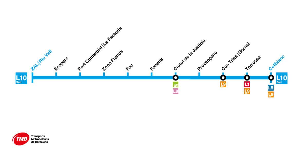
L9/L10 (Orange/Light Blue Lines)
These modern lines connect the city’s major points, including the airport. These lines, which operate with an automatic driving system, are the newest members of the Barcelona metro.
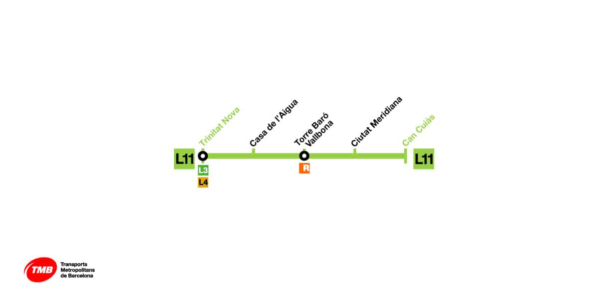
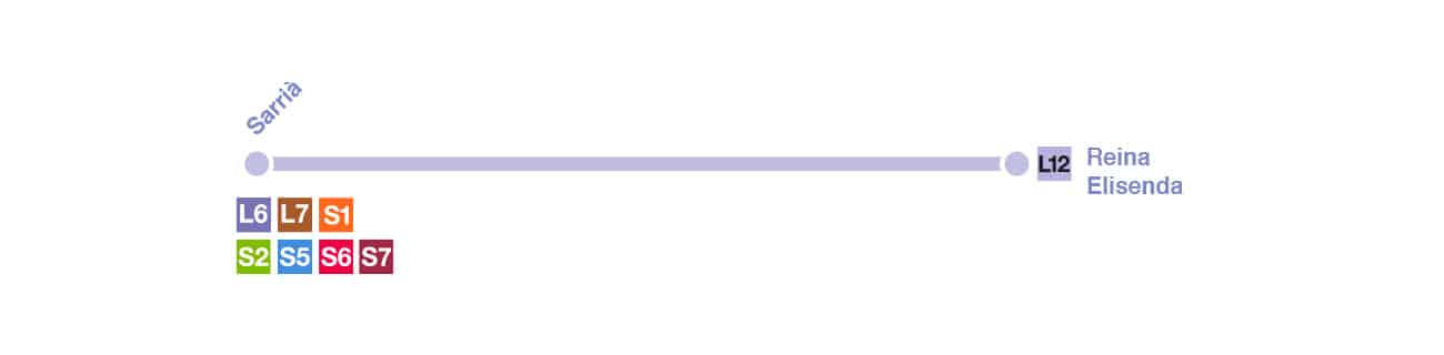
L11 and L12 (Can Cuiàs and Sarrià Lines)
These short lines serve to provide local connections, the L11 Can Cuiàs line and the L12 Sarrià line work in integration with other main lines, completing the transport network.
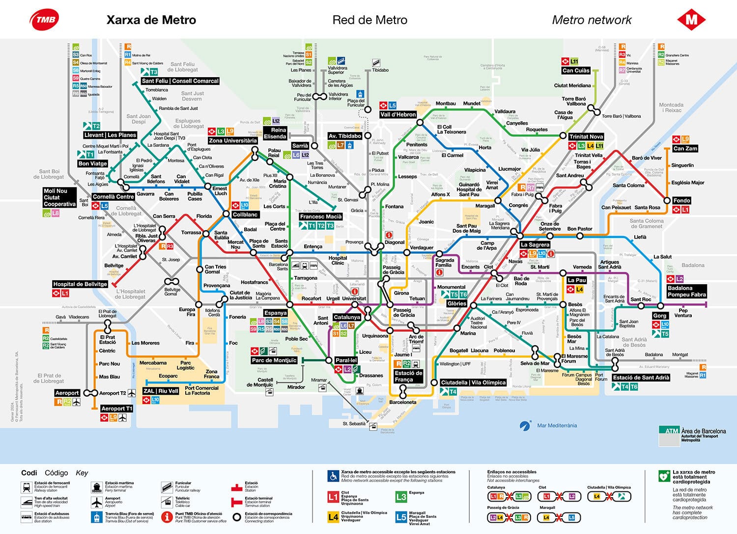
Barcelona Metro Map
I’m sharing the Barcelona Metro Map so that you can use it even when you do not have an internet connection. You can save it to your phone and use it offline.
Tips and Tricks for the Barcelona Metro
When using the Barcelona metro, you need to get a T-Casual card using the machines – you might want to check out the article “How to Get a T-mobilitat Card” for this. The Barcelona metro operates between 05:00 AM and midnight Monday through Thursday, Sundays and public holidays, between 05:00 AM and 02:00 AM on Fridays and evenings before public holidays, and provides 24-hour continuous service on Saturdays and evenings before public holidays.
For more information, you can visit the websites https://www.tmb.cat and https://www.fgc.cat.